
How Rancho Cordova Streets Become Search Trails
A street directory search should begin with one valid address or APN, not a guess at a resident's name. The county parcel map supplies the shape and parcel number. The Assessor can supply public owner and mailing fields through an office channel. The Recorder connects the APN, book/page, and party names to a deed chain. City permits add work history. Reverse directories add older listed occupants. Each layer answers a different question.
- Enter the street address or APN in the Sacramento County Parcel Viewer. Save the situs address, APN, map position, value, and land-use code.
- Zoom to the block and click the seed parcel plus adjacent polygons. Record every APN that truly touches the street segment.
- Request the owner and tax-mailing fields from the Assessor lobby or a records request. Treat mailing as a tax-bill destination, not proof of occupancy.
- Search the current owner or recorder citation in the deed index. Order the image when the index points to a transfer, lien, or map.
- Use the voter route only for an authenticated personal lookup or an approved file purpose. For older households, scan Haines criss-cross and Sacramento-area directories.
The output is a parcel-and-record profile of a street. It becomes a resident lead only when two dated sources agree on the person and place.
Rancho Cordova Parcel Viewer Streets
The interactive Sacramento parcel map supports address locating, APN locating, pan, zoom, parcel clicks, and parcel-map access. It is useful for walking both sides of a street because adjacent polygons can be selected in sequence. It is not a verified public radius-export tool. A map measurement or selection feature should be described only if it is visible in the current version.
Parcel Viewer fields include the street address, APN, assessed land and improvement values, exemption amount, tax-rate area, land-use code, limited characteristics, and a parcel-map link. The county distinguishes the assessment land-use code from legal zoning. Values refresh in early July and mid-September; corrections after September 15 are not reflected in that cycle.
| Field label | Type | Required | Street-search use |
|---|---|---|---|
| Street Address | Text or autocomplete | One search key | Find the situs address in the viewer or PQ Lite |
| Assessor Parcel Number | Text | One search key | Carry the APN into maps, deeds, permits, and requests |
| Map navigation | Pan, zoom, click | No | Select adjacent polygons while walking a street |
| Owner Name | Not offered online | Office route | Request through the Assessor lobby or electronic records channel |
The parcel disclaimer matters when a street line looks exact. Assessment boundaries help locate records, but they are not a legal survey. A subdivision map, deed legal description, or recorded plat controls a title question.
The county parcel screen is the map layer behind this Rancho Cordova street directory search.
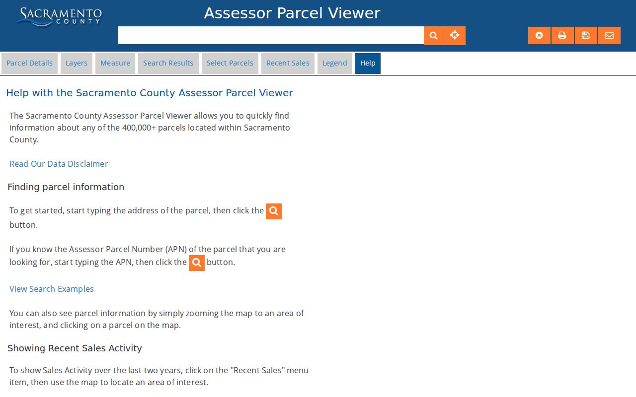
Clicking neighboring polygons supplies APNs for the next owner, deed, and permit checks without assuming that every nearby parcel shares one household.
The county's Parcel Viewer instructions add the cautions that belong beside any mapped street result.
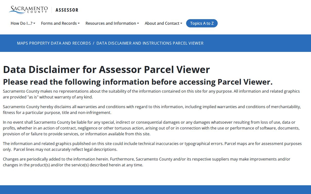
Those instructions keep an assessment map in its proper role: a way to find the record, not a substitute for a legal survey.
Rancho Cordova Owner Names by Street
The public web viewer intentionally leaves owner names out. That can surprise a searcher who expects an address-to-person result. Sacramento County still treats owner and mailing information as public secured-roll fields, with access through the Assessor's lobby computers, direct contact, or a free electronic request through the county's records channel. A street directory should state that split plainly: free parcel browsing first, owner retrieval second.
The Assessor public-records instructions identify assessment rolls, APNs, owner and mailing addresses, values, exemptions, tax-rate areas, zoning, land-use codes, recorder references, parcel maps, and property characteristics. Online access is not the same as full public access. A request may also need a precise address, APN, date range, or field description.
Use the term owner carefully. The roll may show the assessed owner or tax-mailing destination. It does not prove that the named person occupies the parcel today. A trust, business, manager, PO box, or different address can sit between ownership and daily life.
This Assessor public-records view illustrates the boundary that shapes a Rancho Cordova street directory.
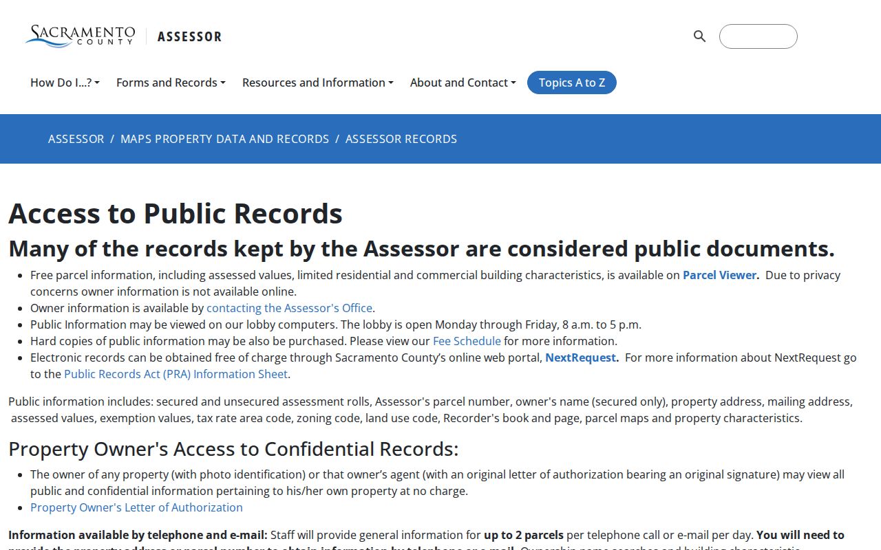
Use the office route when the web map gives the parcel but not the owner field needed for the next deed search.
Rancho Cordova Address Terms
Four address terms can look alike while pointing to different records. Situs is the physical taxable location. Mailing is where the tax bill goes. A legal description identifies the land by lot, block, map, or metes and bounds. ZIP is a mail-routing code. The same Rancho Cordova property can have one value in each field.
- Parcel
- A mapped assessment unit with an APN, which ties the map to the roll.
- Situs address
- The physical location used to place the property in the assessment system.
- Plat
- A recorded subdivision map showing lots, blocks, easements, and related geometry.
- Criss-cross directory
- A reverse reference arranged by address or telephone, useful for scanning a street in an older year.
When a street directory result conflicts with a deed, retain all four fields and check the date. A mailing address may be outside Rancho Cordova. A ZIP may extend beyond the city. A parcel line may reflect assessment use rather than a legal boundary. Precision here prevents a correct record from being attached to the wrong place.
Rancho Cordova Address Records, Layer by Layer
Address-keyed records become more useful when each source is assigned a narrow role. The property roll joins address to parcel. The deed index joins parcel or party to a transfer. A permit joins an address to work, an applicant, or an inspection. A reverse directory joins a historical address to a listed person or phone. A voter file may join an address to an eligible registrant, but only through an approved route.
| Record set | Keeper | What it shows | Access |
|---|---|---|---|
| Assessment roll | County Assessor | APN, situs, values, owner and mailing fields | Parcel viewer plus office request |
| Parcel map | County Assessor | Parcel geometry and adjacent parcels | Free map browse |
| Deed index and image | Clerk/Recorder | Grantor, grantee, transfer, legal description | Free index; copy order or counter |
| City permit file | Rancho Cordova after 2003 | Applicant, contractor, work, dates, inspections | Portal, counter, or CPRA request |
| Reverse directory | Library or archive | Listed occupant, address, and sometimes telephone | Local collections and licensed databases |
| Approved voter file | County Elections | Eligible registrant and precinct evidence | Application, ID, fee, and purpose limits |
The APN is the durable join for property work. The street name is a useful browse key, but it can change or be described under an older place label. Never call the table a complete resident roster. It is a set of evidence paths that can converge on a dated address.
Rancho Cordova Deeds by Street
The Recorder's online index covers documents since 1849 or 1850 and searches by party and recording year. It does not show document images. Search a current owner or grantee, record the document number or book/page, and order the deed or other instrument through the recorded-document index and the county's copy-order process.
For a street directory, the deed chain matters because a current parcel can preserve continuity when a street label or place name changes. A grantor is the transferor; a grantee is the recipient. The current acquisition deed identifies the seller. Searching that seller as an earlier grantee walks the parcel backward through time. Cross-check the APN, legal description, recording date, and book/page at every step.
Copies are separate from index access. The county lists uncertified copies at $8 for the first page and $1 per added page, certified copies at $9 for the first page and $1 per added page, and self-service in-person uncertified copies at $1 per page. Military discharge documents and sensitive identifiers have added access or redaction rules.
The recorder search screen shows why an index citation is the bridge to a deed image.
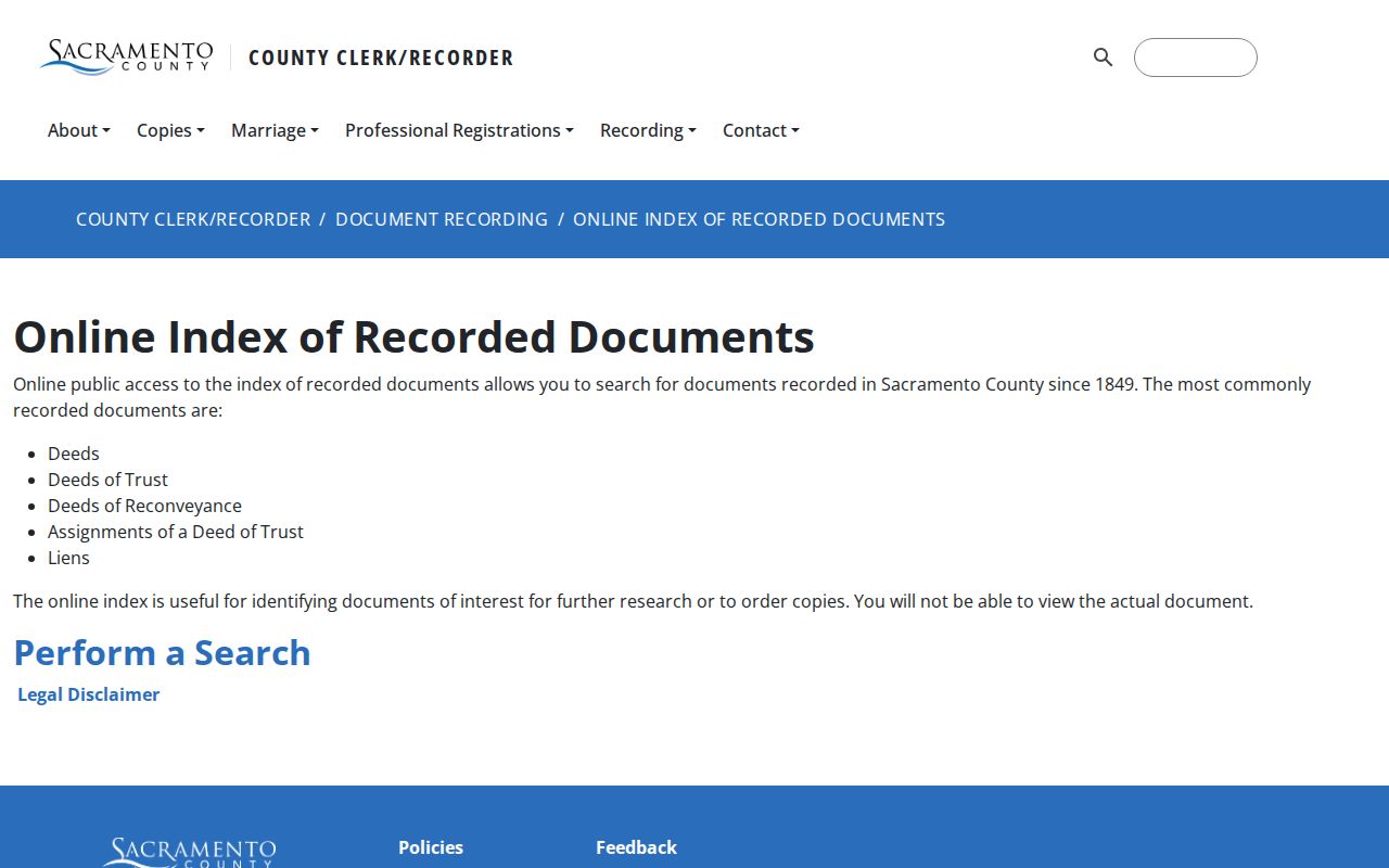
Keep the citation with the APN so a later owner or previous-resident search can return to the same instrument.
Rancho Cordova Street Permits After 2003
Rancho Cordova incorporated July 1, 2003. City permits, plans, inspections, code material, and certificates of occupancy belong to the city era. Earlier construction and land-use evidence may sit with Sacramento County. The Rancho Cordova Online system supports applications, renewals, payments, uploads, inspection scheduling, and document or status review. The city's resident license and permit information also identifies address-linked local channels. Building and Safety lists counter service Monday through Friday from 8 to 12 and 1 to 4:30, with last service 30 minutes before closing.
A permit can show an applicant, contractor, work description, issue or final date, valuation, address, parcel, inspection milestone, or certificate-of-occupancy trail. It dates an alteration or construction event. It does not establish that the applicant lived at the address. A city clerk request can reach certificates of occupancy and other files when the portal does not expose the needed field.
For a pre-city address, describe the old place name and date range. Sacramento, Mills, Mather, Brighton, and suburban descriptions can matter as much as the current city label.
Rancho Cordova ZIPs Along Streets
Rancho Cordova's two core postal ZIPs help sort a search, but they do not define the city. ZIP 95670 follows established Rancho Cordova corridors along Folsom Boulevard and US-50 and can also carry Gold River postal use. ZIP 95742 follows newer eastern growth and commercial or industrial tracts. Mather 95655, Sacramento 95827, and nearby 95608 or 95829 references can appear in broader service and planning records without becoming core Rancho Cordova ZIPs.
The USPS ZIP Code Lookup is the controlling check for one address. Then use city and county GIS for jurisdiction, an APN for property records, and the deed or plat for legal continuity. Postal city, voting area, school boundary, tax district, and incorporated city can all differ.
That mismatch is why a street directory search should preserve the exact delivery address rather than replace it with a city label. An older 95670 entry may sit outside the incorporated boundary, while a newer eastern parcel may have a rural or development description before the street is built out.
Rancho Cordova Street History in Haines
Modern parcel records are strongest for current land. For older listed households, Sacramento-area city, county, telephone, and Haines suburban directories supply a different form of street directory. The Haines city-and-suburban products document examples from 1984 through 2018. A reverse section starts with the address, then gives an occupant or telephone clue. An alphabetical section may add an occupation, spouse, employer, or abbreviation.
Read both parts. Scan a known address in one year, move one volume at a time, and note first and last appearances. Search alternate spellings, initials, spouse names, employer clues, and old place labels. A missing entry does not prove a move. The directory may have omitted a household, left an unlisted telephone out, or used a boundary that did not include the address.
The full history of the Sacramento collections belongs in the Rancho Cordova city directory collection treatment. Here, the criss-cross volume is a tool for connecting an address to an earlier listed household.
What a Rancho Cordova Street Directory Omits
A street directory cannot show every person at a parcel. It may not show unlisted household members, private utility customers, DMV addresses, protected Safe at Home participants, or people who never appeared in a directory or voter file. Multiunit parcels can carry one owner and many unlisted households. A permit applicant can differ from the person using the property.
California voter data is purpose restricted under Elections Code sections 2188 and 2194. The federal Driver's Privacy Protection Act limits DMV address data. Utility customer details can be exempt. An HOA, school, congregation, or watch contact is not authority to publish a member list. Public availability of one record does not erase the privacy rule attached to another.
Lawful personal use. Use address records for family history, property research, civic review, and safe reconnection. Do not use a Rancho Cordova street directory to stalk, harass, intimidate, or harm anyone. The custodian, not a directory page, decides what a record confirms.
A careful by-address result states what the source shows and what it leaves unknown. That distinction is the difference between a useful street directory and an invented resident roster.